Picking the right top 10 Slope Stability Radar suppliers in China isn’t just about flipping through product brochures. You really need systems that can catch tiny ground movements early — before cracks even become visible and dangerous. Plus, they should keep delivering steady data no matter if it’s raining, dusty, dark, or if there’s heavy traffic in the mine.
In this rundown, I’m looking at the main players serving China’s mining, quarrying, hydropower, and infrastructure sectors. We’ll compare things like how far they can monitor, how sensitive their measurements are, how fast they scan, the software features, installation help, and support after purchase. Some brands like GroundProbe, Reutech Mining, IDS GeoRadar, Hexagon, and others do pretty well in real-world conditions — but they’re not all the same. And let’s not forget—just because a radar system costs less doesn’t mean it’ll save you money in the long run. Things like calibration, training, analyzing the data, and maintenance can really affect the final bill.
Experience out in the field is what really counts.
Dr. David Noon, who founded GroundProbe, has a good saying: “Radar should support your engineering judgment, not replace it.” That’s a solid mindset whenever you’re looking at different suppliers. Sure, radar can spot movement across a slope, but you still need to understand the geology, track rainfall, check prism readings, and do regular site visits. Some systems might work great in a dry open pit but struggle near reflective structures or unstable communication networks — something you definitely want to consider.
So, just a heads-up: the rankings here are meant to give you a general idea, not set in stone. Companies evolve and improve, and local support can vary a lot. Before making a decision, make sure to double-check specs, references, cybersecurity measures, warranty details, and how they handle support after you buy. The best choice isn’t always the biggest or most popular brand — it’s the one that gives you reliable measurements, clear warnings, and real help when the situation gets complicated.
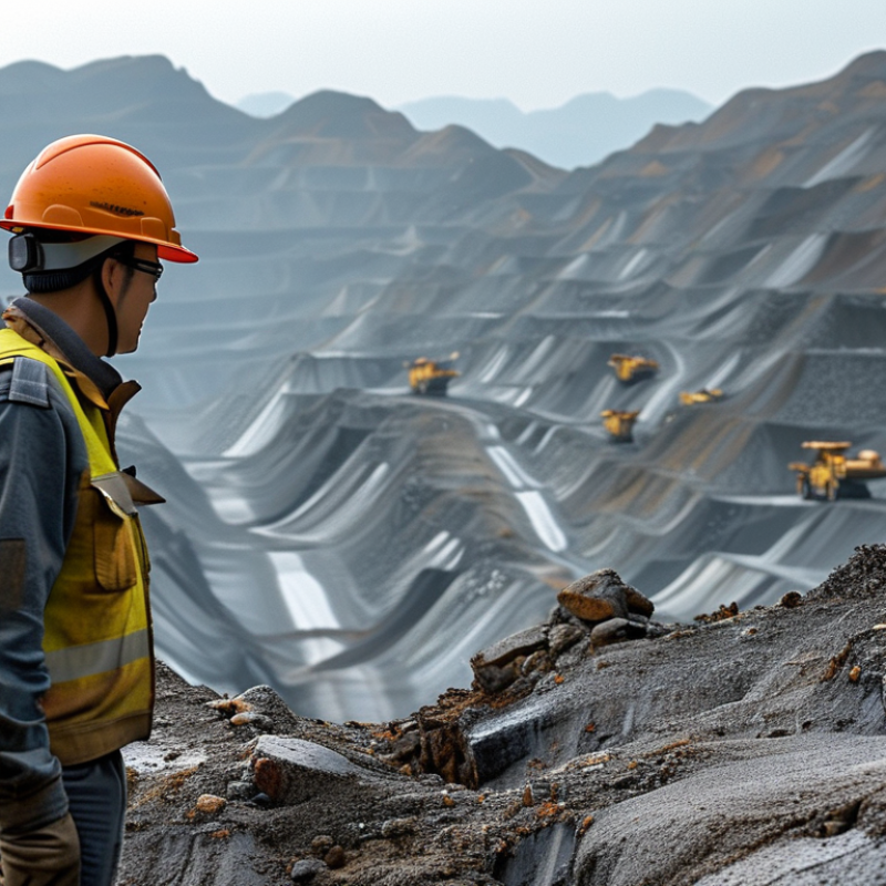
Slope stability radar is a ground-based monitoring system that measures tiny surface movements across mine walls, waste dumps, and open-pit benches. It sends radar signals toward a slope and compares repeated scans. Millimetre-scale changes can reveal accelerating movement before cracks become obvious to workers.
This matters in China because mining operations are large, deep, and often exposed to seasonal rain. The National Bureau of Statistics reported about 4.71 billion tonnes of raw coal production in 2023. The International Energy Agency also identified China as responsible for more than half of global coal output. Such scale makes early geotechnical warning essential, especially where a single unstable bench can disrupt haul roads and production.
Radar works day and night, through darkness and moderate dust. It can monitor wide areas without placing instruments directly on unstable ground. Data is presented as movement maps, velocity trends, and alerts for accelerating zones. The Global Mining Guidelines Group recommends combining radar with geological mapping, prism measurements, and groundwater observations. Radar is powerful, but not magical. Heavy rain, vegetation, blind angles, or poor surface reflectivity can affect readings. Engineers must still verify alerts on site and review thresholds regularly. A rushed alarm may create unnecessary stoppages; a weak threshold may delay action. That balance remains a practical challenge for Chinese mines.
Evaluating China’s top Slope Monitoring Radar suppliers requires more than comparing detection range or purchase price. Check field experience first. Ask for completed open-pit, quarry, or hydropower projects with similar slope geometry. The radar should detect displacement at millimetre or sub-millimetre scale, but published performance depends on range, surface reflectivity, atmosphere, and installation angle. The FHWA Geotechnical Instrumentation and Monitoring Manual stresses that monitoring quality depends on sensor placement, baseline surveys, and independent verification. Request raw data, alarm histories, and maintenance records, not only marketing charts.
Test the system under real conditions. Measure update intervals, data availability, false-alarm frequency, and performance during rain, dust, fog, and power interruptions. A practical trial should compare radar readings with prisms, GNSS, or robotic total stations. ISO 18674-1:2015 supports combining complementary instruments for geotechnical monitoring. Also examine software usability: Can engineers review a displacement trend from a phone at 3 a.m.? Are alerts graded by velocity and acceleration? These details matter.
Supplier reliability needs equal attention. Review calibration procedures, cybersecurity controls, spare-part access, training, and response times inside China. Industry reports often cite rapid growth in mine automation, yet deployment quality remains uneven. That is the uncomfortable part. A low-cost radar may produce impressive images while missing a weak signal behind vegetation. Demand a documented acceptance test, clear accuracy limits, and a written service-level agreement. Pilot results should decide the shortlist, not a ranking page.
China’s slope stability radar sector is expanding with deeper mining, large open pits, and stricter digital safety controls. A practical Top 10 review should examine sensor range, measurement accuracy, data latency, installation support, and after-sales response. Supplier names alone can mislead buyers.
According to the Global Mining Guidelines Group’s 2023 monitoring guidance, radar systems support continuous, remote deformation measurement and reduce reliance on periodic surveys. The guidance stresses independent validation and clear alarm thresholds. That matters in China, where rain, blasting, dust, and steep benches can distort readings. Strong suppliers should provide terrain modeling, weather compensation, and interpretable alerts. Not just colorful dashboards.
The International Council on Mining and Metals reported 33 occupational fatalities among member companies in 2023. This figure does not measure slope failures directly, but it reinforces the need for layered risk controls. China-based suppliers increasingly combine ground-based radar with GNSS, prisms, drones, and automated warnings. Buyers should request trial data from comparable rock conditions before choosing equipment. Slope Stability Assessment must include false alarms, missed movements, network reliability, and operator training. Some published specifications look impressive, yet field performance can vary. That deserves honest review.
| Rank | Supplier Code | Primary Radar Configuration | Typical Detection Range | Typical Update Interval | Monitoring Coverage | All-Weather Capability | Common Deployment Environment | Key Integration Functions | Typical Market Position |
|---|---|---|---|---|---|---|---|---|---|
| 1 | Supplier 01 | Ground-based scanning radar | Up to 4 km | 1–5 minutes | Up to 360° panoramic scanning | IP-rated outdoor enclosure | Open-pit mines and large cut slopes | Displacement maps, alarm zones, historical trend analysis | Enterprise |
| 2 | Supplier 02 | Ground-based interferometric radar | Up to 3 km | 2–10 minutes | Wide-area sector scanning | Rain and dust-tolerant design | Mine benches and quarry walls | Real-time deformation velocity and threshold alerts | Enterprise |
| 3 | Supplier 03 | Compact fixed-position radar | Up to 2 km | 1–15 minutes | 120°–180° sector coverage | Outdoor continuous operation | Road cuts and infrastructure slopes | Remote dashboard, SMS or email alarms, data export | Mid-market |
| 4 | Supplier 04 | Portable scanning radar | Up to 2.5 km | 5–30 minutes | Adjustable sector coverage | Weather-protected field unit | Temporary construction slopes and emergency surveys | Rapid setup, portable power, local data storage | Project-based |
| 5 | Supplier 05 | Continuous slope-monitoring radar | Up to 3.5 km | 1–5 minutes | Wide-area, multi-zone monitoring | 24/7 outdoor operation | Metal mines and highwall operations | Fleet-management interfaces, alarms, API connectivity | Enterprise |
| 6 | Supplier 06 | Short-range slope radar | Up to 1 km | 1–10 minutes | 60°–120° sector coverage | Outdoor enclosure with heating control | Urban excavations and retaining slopes | Local warning lights, audible alarms, web monitoring | Value-focused |
| 7 | Supplier 07 | Remote slope surveillance radar | Up to 2 km | 5–20 minutes | 180° panoramic monitoring | Solar-powered remote deployment | Remote mountainous areas and dams | 4G or satellite backhaul, cloud alarms, battery status | Specialized |
| 8 | Supplier 08 | High-resolution interferometric radar | Up to 1.5 km | 1–10 minutes | Detailed localized monitoring | Weather-resistant field installation | Research sites and critical slopes | High-resolution deformation analysis and GIS export | Specialized |
| 9 | Supplier 09 | Integrated radar and sensor platform | Up to 2 km | 5–30 minutes | Radar plus sensor-defined zones | Outdoor monitoring cabinet | Transport corridors and hydropower projects | Integration with GNSS, inclinometers, rainfall and video | Solution-based |
| 10 | Supplier 10 | Entry-level fixed radar system | Up to 800 m | 10–30 minutes | 60°–90° sector coverage | Basic outdoor protection | Small quarries and local construction sites | Basic dashboards, threshold alarms and CSV reporting | Value-focused |
Note: Supplier identities are intentionally omitted. Technical figures are representative market ranges for China-based slope-stability radar solutions and should be verified against current product specifications before procurement.
China Top 10 Slope Stability Radar Suppliers: Key Technologies and Features
China’s leading ten slope stability radar suppliers generally combine ground-based interferometric radar, automated scanning, and remote alarms. Their systems measure millimetre-scale surface movement without physical contact. Many offer 360-degree coverage, rapid scanning, and configurable monitoring zones. Some platforms integrate cameras, GNSS, rainfall gauges, and crack sensors. That integration matters when dust, fog, or blasting affects radar readings.
The strongest solutions usually provide continuous monitoring, sub-millimetre displacement sensitivity, and real-time trend analysis. Edge computing can filter unstable data at the pit. Cloud dashboards support multi-site access. Several suppliers now use machine learning to identify acceleration before visible failure. However, algorithms still need experienced engineers. A warning is not a decision. The Global Tailings Portal records more than 1,800 tailings facilities worldwide, highlighting the need for scalable monitoring and clear escalation procedures. Remote monitoring helps, but poor installation can weaken reliable performance.
Data exchange is another differentiator. Open APIs, GIS compatibility, and standard alarm protocols simplify integration with control rooms. Some suppliers support solar power, 4G, satellite links, and rugged enclosures for remote mines. European space-agency mission specifications show how repeated radar observations can support wide-area deformation screening, although satellite data cannot replace local radar during rapid movement. Cost remains difficult to compare. A cheaper sensor may create higher inspection and maintenance costs. No ranking is permanent; field calibration, operator training, and transparent accuracy reports deserve more attention.
Number of leading commercial slope stability radar suppliers with publicly documented support for each capability. The comparison focuses on commonly offered technologies rather than company or brand performance.
Feature coverage is summarized from publicly available commercial product specifications and technical literature. Availability, performance, and operating range depend on the selected system configuration and site conditions.
China’s slope monitoring market serves open-pit mines, dams, and major infrastructure projects. Supplier comparison should go beyond radar sensitivity. Slope Stability Monitoring also depends on coverage, data continuity, and emergency support.
The World Bank’s Minerals for Climate Action report projects mineral production could rise nearly 500% by 2050. This pressure increases demand for reliable, wider-area monitoring. A practical supplier review should examine detection range, scan frequency, weather resistance, and false-alarm control. Coverage matters on stepped benches, where blind zones can hide small cracks. Service support matters too. A strong supplier provides installation training, remote diagnostics, spare parts, and local engineers. The Global Mining Guidelines Group’s slope radar guidance stresses site-specific design and clear alarm procedures. Performance data should therefore include uptime, alert response time, and verified displacement records, not only brochure specifications.
Tips: Request a twelve-month uptime record and three comparable site references. Check whether support teams can reach remote mines within hours, not days. Ask for raw data access. It protects independent review.
Supplier rankings can look precise, but field conditions change quickly. Heavy rain, dust, and unstable communication networks may reduce actual coverage. I would also question results based only on laboratory accuracy. That comparison is incomplete. Procurement teams should test one radar unit during a difficult season before expanding deployment. Rescue planning, operator training, and cybersecurity deserve equal attention. Yet these factors are often scored poorly or ignored.
Selecting among China’s top 10 slope stability radar suppliers requires more than comparing prices. In Slope Stability Geotechnical Engineering, site conditions determine performance. Ask for measured accuracy, detection range, update speed, and alarm latency. A radar should identify movement before cracks become visible. Request raw data from a rocky slope, not only polished demonstrations.
The 2023 WMO and UNDRR report found that 101 countries reported multi-hazard early warning systems. This supports integrated monitoring, not radar-only decisions. Check whether the Chinese supplier can connect radar data with GNSS, prisms, rainfall gauges, and geotechnical inspections. Review calibration certificates, software logs, cybersecurity controls, and repair procedures. ISO 9001 certification helps, but it does not prove field reliability. Visit the factory if possible. Inspect antenna sealing, cable protection, and temperature testing. Ask for references from mines or open excavations with similar geometry. Small details matter.
Demand a written acceptance test. Define detection thresholds, false-alarm limits, data ownership, and response times. Confirm spare-part availability and remote-support hours across your time zone. A low quotation may exclude installation, training, or long-term maintenance. That is where budgets often bend. I would also challenge unusually perfect accuracy claims. Real slopes are noisy. Rain, dust, vegetation, and moving equipment can confuse interpretation. The right supplier explains these weaknesses clearly and shows how its engineers manage them.
: It is a ground-based system that detects tiny movements across mine walls and open-pit benches. It uses repeated radar scans. Millimetre-scale changes may appear before visible cracks.
Chinese mines can be large, deep, and exposed to seasonal rain. A moving bench may threaten haul roads and interrupt production. Continuous monitoring supports earlier decisions.
Yes, radar can operate day and night. It can also work through moderate dust. However, heavy dust, vegetation, and blind angles may reduce reliability.
No. The system monitors surfaces remotely. This reduces the need to install instruments directly on dangerous ground.
It can produce movement maps, velocity trends, and acceleration alerts. Some systems show changing zones across a bench. A clear map is more useful than a colorful dashboard alone.
Systems may connect with cameras, GNSS, prisms, rainfall gauges, and crack sensors. GIS tools, open APIs, and standard alarms can support control-room integration. Satellite links may help remote sites.
It should not work alone. Engineers should compare radar results with geological mapping and groundwater observations. On-site checks remain necessary. Radar is powerful, not magical.
Heavy rain, blasting, poor surface reflectivity, and network problems can affect readings. Incorrect installation may also weaken results. A rushed alarm can stop work unnecessarily. A weak threshold can delay action.
Buyers should compare range, accuracy, scan speed, data delay, support, and maintenance. Trial data from similar rock conditions is valuable. Ask about false alarms and missed movements. Specifications can look impressive. Field results matter more.
This article presents a practical guide to China’s top 10 Slope Stability Radar suppliers and explains how this technology supports safer, more efficient mining and infrastructure operations. It introduces the principles of radar-based slope monitoring, including real-time displacement detection, wide-area coverage, operation in challenging weather, and early warning capabilities. The discussion also explains why Slope Stability Radar is increasingly used in China, where complex terrain, large excavation projects, and demanding safety requirements call for continuous monitoring.
The article outlines key criteria for evaluating suppliers, such as detection accuracy, scanning range, data-processing capabilities, system reliability, integration with alarms and control platforms, installation expertise, and after-sales service. It then compares leading Chinese suppliers by technology features, performance, monitoring coverage, customization options, and technical support, without focusing on brand identities. Finally, it offers practical advice for selecting the right supplier based on project scale, geological conditions, environmental challenges, budget, response requirements, and long-term maintenance needs.